EarthState

3D Lab

Models built automatically, then shown as they are

The 3D Lab is where a structure becomes a model: from drawings, from a laser scan, or both. The same model then drives a live twin you can fly through, a photoreal turntable and ray-traced films.

Automated modelling

Two ways into 3D, neither drawn by hand

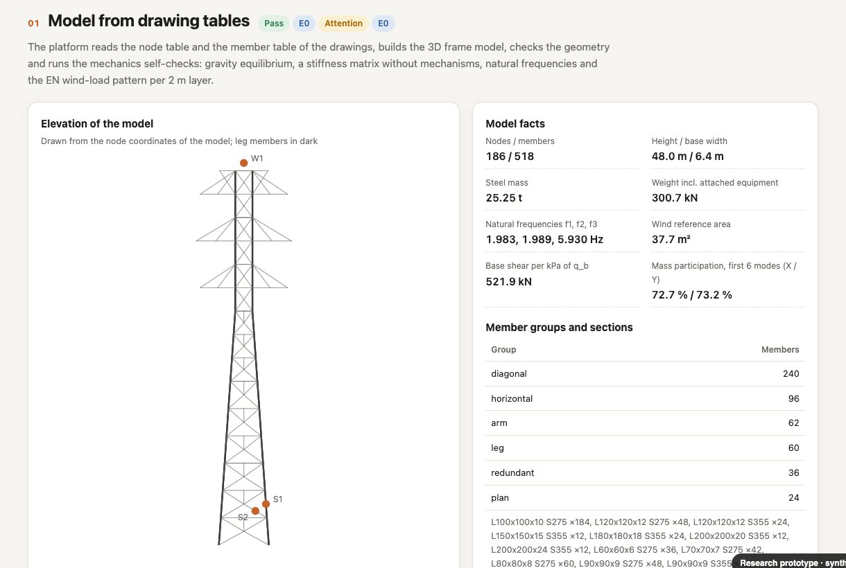
A lattice tower model built from drawing tables, with model facts and member sections.
From drawings

Vector PDF drawings to a member-level model

The lines, dimension chains and labels of a CAD drawing set are read directly. Against an independent model of the same tower, 90% of members matched and 97% of nodes lay within 150 mm.
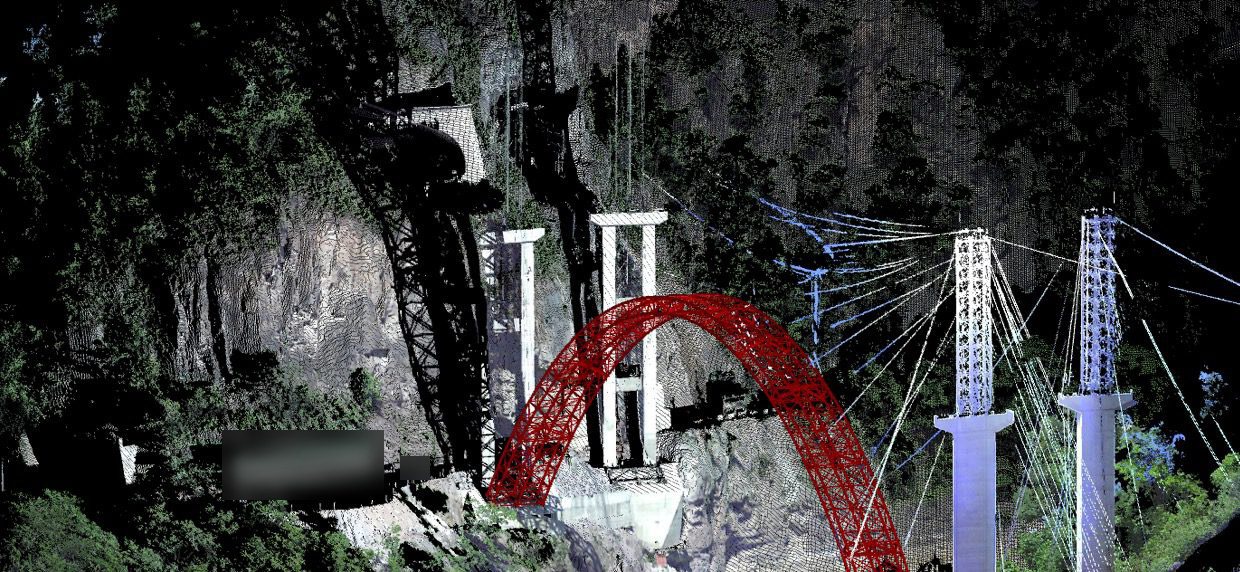
Laser-scan point cloud of a long-span arch bridge during construction.
From point clouds

Laser scans to geometry and analysis

Components are recognised in the point cloud and fitted with parametric geometry, then handed to structural analysis. On a real bridge the method reached 91% Intersection over Union against critical outlines.

Drawing figures from one real 66 m tower with anonymised geometry; independent engineering review is in progress. Point-cloud figures from the founder's published work.

Live twin

Turn it, click it, fly along it

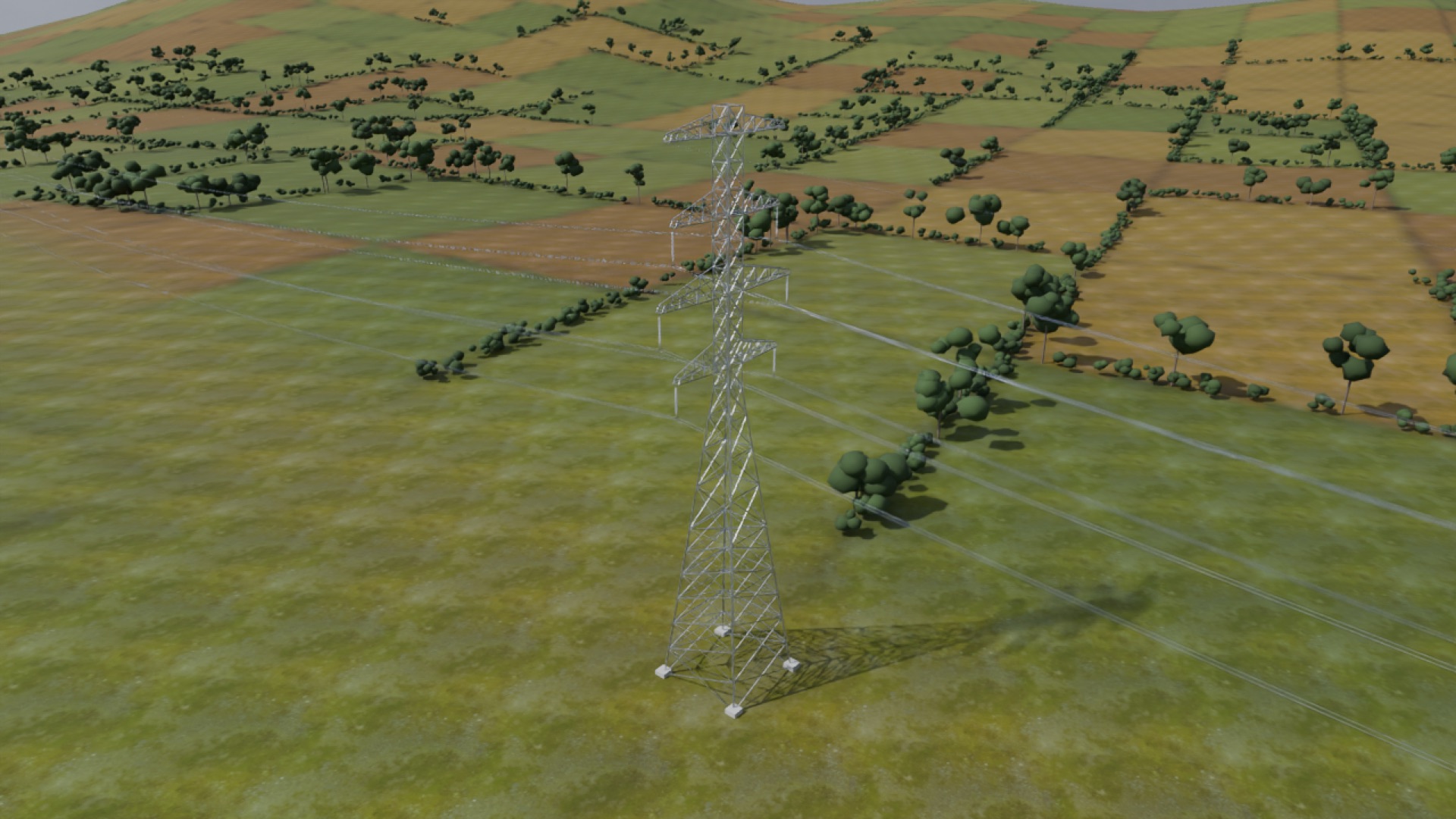
A lattice steel tower and line on farmland, rendered from the 3D model.

Double-circuit lattice steel tower, 340 m spans. The tower, conductors and terrain are procedurally generated illustrative models, not design drawings. Utilisation colours are synthetic demonstration data (evidence level E1), not calculation results. Open full screen.

Tab 1

Live twin

Fly with W A S D, jump between preset views, hover any member for its section, length and utilisation, and watch the colour map refresh every few seconds.

Tab 2

Photoreal turntable

Ray-traced frames in three rings. Drag to turn, drag up or down to change elevation, click any part to identify it.

Tab 3

Films

A fly-along of the line and a drone orbit of the tower, rendered offline.

Films

Ray-traced, from the same model

Fly along the line · 1080p · 9 s
Drone orbit · 720p · 6 s
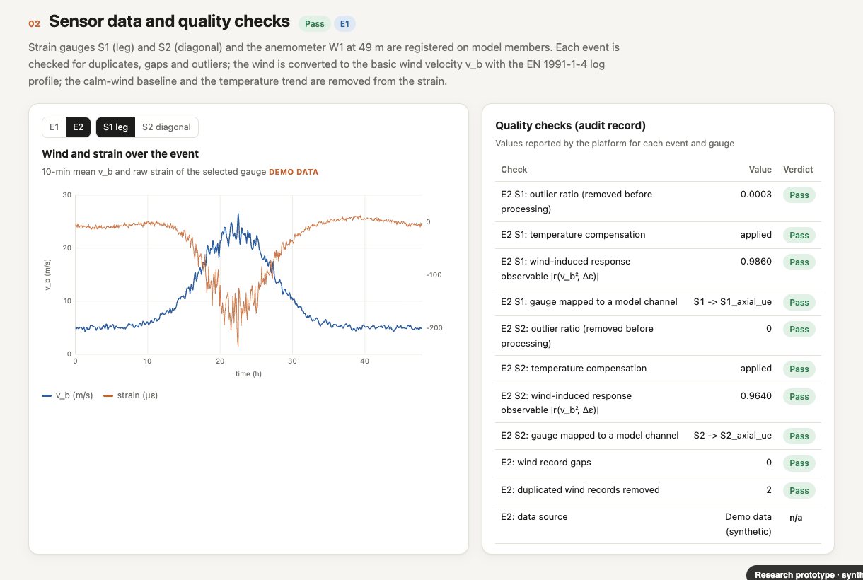
Wind and strain records over an event, with quality checks listed as an audit record.
EarthState Twin · sensor data on the model · demo data

AIoT

Then the sensors go onto the model

Each gauge is registered on the member it sits on, its records are checked and corrected, and the twin is calibrated against measurement and validated on an event it has not seen.

AIoT and sensors

Why it matters

Results people can see, and data machines can learn from

Owners and reviewers understand a structure faster when they can turn it and click it. The same pipeline also writes depth, segmentation and camera layers for every frame: physically consistent synthetic data for training vision and world models.

Coming next

Real sites

Gaussian-splat captures of real structures, aligned with their analysis models, so a site visit and a structural result can be viewed in one place.

Want your asset modelled and shown this way?